
English| EUR
Suggested for you
More currencies
Choose a language
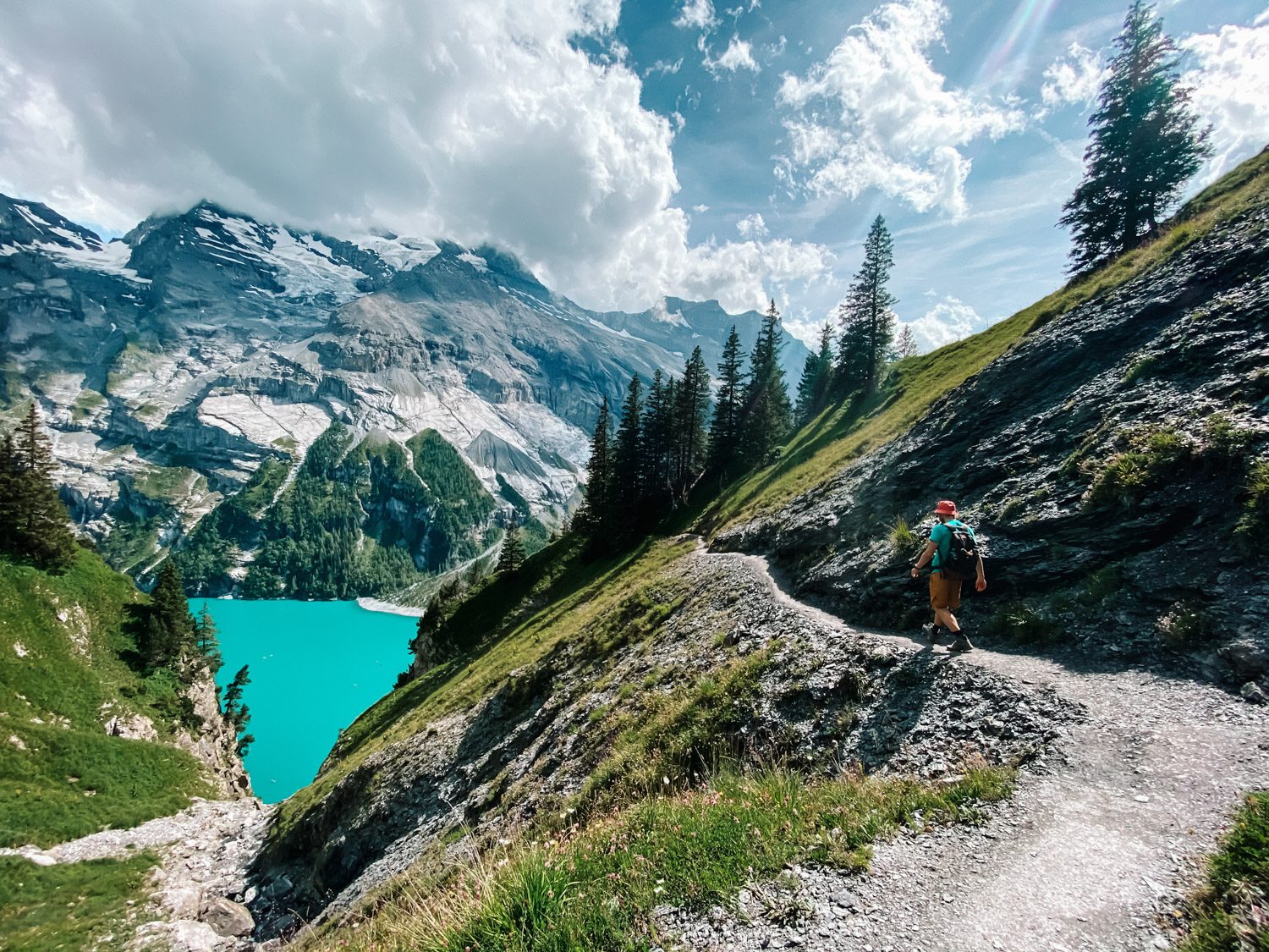
The basin below the Blüemlisalp sits at 1,578 metres, roughly 400 metres above Kandersteg, and how long the walk takes depends less on distance than on which end of it a visitor starts from. This lake oeschinensee hike time guide sets out realistic durations for the climb, the descent and the balcony trails above the shore. It also explains where the Oeschinensee Wanderung differs from the short stroll down from the gondola top station.
Quick answer
Walking up from Kandersteg to Lake Oeschinen takes most hikers about 1 hour 30 minutes, covering roughly 400 metres of ascent; the descent runs closer to an hour. Visitors who ride the gondola instead need about 20 minutes on foot from the top station down to the shore. The lake itself is free to enter, and the site operates 08:30–18:00 daily.
Oeschinensee has no visible outflow. Meltwater from the Blüemlisalp glaciers collects in the basin, then drains through the rockslide debris beneath it and resurfaces as springs in the Kander valley. That hidden plumbing is a clue to the terrain: the lake sits at 1,578 metres in a bowl of moraine and cliff, roughly 400 metres above Kandersteg village, and the climb between the two is what turns lake oeschinensee hike time into a genuine planning question rather than a formality. The number depends on where the walk starts. From the valley floor, the forest path and gravel service road gain height steadily and take most reasonably fit walkers well over an hour; the return leg is quicker. From the gondola top station, the approach is a short downhill stroll to the shore, wide enough for pushchairs and manageable in trail shoes. Beyond that, the Oeschinensee Wanderung fans out: the Heuberg panorama circuit above the north shore, the steeper haul toward Unterbärgli and Oberbärgli, and the long day up to the Fründenhütte beneath the Fründenhorn. Each of those adds hours, not minutes. Conditions shift the arithmetic. Snow lingers on the higher balcony paths into early summer, and by late October shaded sections above the lake ice over. Rain turns the moraine underfoot greasy. The descent is the leg most people underestimate, particularly on the direct forest route, where loose gravel forces a shorter, slower stride than the map suggests. Families walking at a child's pace should budget for stops rather than trust an average. Use the figure to build the day backwards. Decide whether the return will be on foot or by cable car, then work back from the final departure of the day; the operating window, the fare and the recommended arrival slot are set out in the sections below. Walkers who intend to ride down should hold a margin at the top station, especially in the peak weeks of summer, when the queue moves slowly. Those continuing on foot should carry a headlamp late in the season, when dusk reaches the valley early. Anyone folding a Kandersteg lake hike into a wider Bernese Oberland itinerary will find that a realistic lake oeschinensee hike time is the difference between an unhurried afternoon by the water and a rushed march back down to Oeschistrasse.
“The lake has no visible outlet, and the walk up to it has no shortcuts.”
This plan suits moderately fit walkers who want the full lakeshore circuit plus time to sit by the water, and runs roughly six hours from the Kandersteg valley station to the return descent. Slower walkers can stop after the shoreline path and still see the lake properly.
Reach Oeschistrasse 50 in the recommended 08:30–10:00 arrival window, allowing 15–30 minutes for the gondola queue and boarding. Fill water bottles before you ride up.
The gondola takes about 8 minutes to Oeschinen station, then a gravel service road descends 20–25 minutes to the lake basin. The gradient is easy but loose underfoot in places.
Follow the northern shore trail from the Berghotel Oeschinensee terrace toward the alluvial fan at the eastern end, around 40 minutes each way on level ground. This is the flattest option and works for most fitness levels.
The complete circuit takes 2–2.5 hours with a rocky, exposed stretch on the southern side that requires proper shoes. Anyone unsure of footing should turn back and retrace the northern path instead.
Stop at Berghotel Oeschinensee or Restaurant Oeschinensee for 45–60 minutes. Terrace tables fill quickly between 12:00 and 14:00.
A steeper 45-minute ascent above the northern shore gives a view over the whole basin toward the Blüemlisalp wall. Add 30 minutes for the descent.
Allow 30–40 minutes uphill on the service road back to the gondola, or 60–75 minutes if you walk the whole way down to Kandersteg on the marked footpath.
The best arrival window is 08:30–10:00 to avoid mid-day crowds and ensure availability of preferred gondola time slots. Timing your visit during shoulder seasons or early weekdays significantly impacts trail congestion and the overall duration of your hiking experience.
Warm, 15°C to 22°C. Trails are fully accessible with high foot traffic.
July and August see peak density; arrive at opening to secure gondola capacity.
Cooler, 5°C to 15°C. Lower temperatures provide comfortable hiking conditions.
Fall offers stable weather and fewer crowds, ideal for longer hiking routes.
—
Early arrivals provide the most solitude and flexibility for completing longer trail circuits.
Verdict: The optimal time to visit is Tuesday to Thursday between 08:30–10:00 during the months of September or October.
Lake Oeschinensee is located above the village of Kandersteg, Switzerland. The most direct approach involves traveling to the Kandersteg cable car station followed by a gondola ascent and a short walk.
BLS train line to Kandersteg station
Local Kandersteg bus to Oeschinen Gondola stop
Walk from Kandersteg station to gondola base
Gondola top station to Lake Oeschinensee
The gondola ride is essential for shortening the ascent. Travelers should aim for the 08:30–10:00 arrival window to ensure availability and avoid mid-day queues at the Oeschistrasse 50 base station.
Lake Oeschinensee is open daily to accommodate hikers throughout the week.
Access to the Lake Oeschinensee area is free, though costs are associated with the cable car transport from Kandersteg. Budgeting for your hike should primarily account for the gondola fare.
Verdict: A typical adult pays approximately 40 CHF for a return cable car ticket, which varies based on seasonal rates or regional travel passes.
Everything you need to know about lake oeschinensee hike time
The typical lake oeschinensee hike time from the mountain station to the water's edge takes approximately 20 to 30 minutes on foot. If you plan to walk the full panoramic loop, you should allocate several hours for the experience. Planning your lake oeschinensee hike time effectively helps you enjoy the scenery at a relaxed pace.
Yes, it is possible to hike up from Kandersteg to the lake, which adds significant elevation and duration to your excursion. This alternative route requires more stamina than simply using the gondola. Consider how your chosen path impacts your total lake oeschinensee hike time before setting out.
Many sections of the mountain trails are manageable for active children, though steep segments exist near the cliffside paths. Ensure you monitor the weather and keep track of your lake oeschinensee hike time to return before the cable car stops operating. Always stick to marked paths for safety.
To avoid mid-day crowds and ensure availability, the best arrival window is between 08:30 and 10:00. Arriving early allows you to complete your trek before the peak visitor volume. This timing also provides the best natural lighting for photography along the alpine trail.
There is no entrance fee to access the hiking trails around the lake. You only need to purchase a ticket for the cable car ride, which costs approximately 40 CHF for a return trip. All other access to the surrounding peaks remains free of charge.
Bring sturdy hiking boots, weather-appropriate clothing, and sufficient water for your trek. Sun protection is essential at this altitude, even on cooler days. Check the official site for current trail conditions before starting your journey.
Kandersteg to Lake Oeschinensee Hike Guide
Read more GuideHike to Oeschinen Lake: Getting There
Read more GuideLake Oeschinensee Hike Seasonal Opening
Read more Tickets & toursLake Oeschinensee Hike from Interlaken
Read more GuideLake Oeschinensee Hike Difficulty & Length
Read more GuideLake Oeschinensee Hike Trail Map & Route
Read more