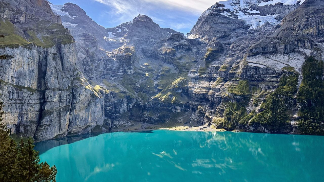
Oeschinensee Shoreline
The primary lakefront area offers views of the turquoise water and the surrounding cliffs of the Blüemlisalp massif.
Walk to the western edge for fewer crowds and clear perspectives.

The village of Kandersteg sits roughly 400 metres below the turquoise basin of Oeschinensee, and the gap between them can be closed on foot, by gondola, or by some combination of both. This kandersteg to lake oeschinen hike guide sets out what each option actually demands of a walker. Read on for the plain answer, then the context that makes it useful.
Quick answer
Reaching the lake area itself costs 0 CHF — entry is free, and the fee applies only to the Kandersteg–Oeschinensee gondola, which runs 08:30–18:00 every day of the week. Walking up from the village on the forest road is the no-cost alternative. Arrive between 08:30 and 10:00 in high season: parking fills quickly and lift queues build through late morning.
Oeschinensee holds UNESCO World Heritage status as part of the Swiss Alps Jungfrau-Aletsch region, yet the lake has no natural outflow above ground — water drains through fissures in the limestone and resurfaces near the valley floor. That geology explains the colour: glacial silt suspended in cold, still water beneath the Blüemlisalp massif. What a visitor faces on the kandersteg to lake oeschinen hike is essentially a question of vertical distance. Kandersteg sits at roughly 1,200 metres; the lake basin lies near 1,580. The Oeschinensee Wanderung, as the route is signposted in German, follows Oeschistrasse out of the village and climbs steadily on a surfaced service road through spruce forest before the gradient eases at the treeline. It is a walk, not a scramble — no fixed ropes, no exposure — but the sustained ascent is what surprises people who assumed a lakeside stroll. Families and anyone travelling with limited time often take the gondola in one direction and descend on foot, which removes the climb while keeping the walk. The mountain hut terraces at the far end, the rowing-boat jetty, and the Fründenhütte path that continues beyond the shore all sit within reach once the basin is gained. The practical consequence is that this Lake Oeschinen walking route is best understood as a flexible pairing rather than a single fixed itinerary. Weather in the Bernese Oberland turns fast, and the upper basin holds cloud after the valley has cleared; checking conditions before committing to the ascent is worth the two minutes. Footwear matters more than gear lists suggest, since the descent on gravel is where most slips happen. In August 2026 the trail is in full summer condition, though snow patches can linger on the higher connecting paths above the lake well into the season. Anyone planning a kandersteg to lake oeschinen hike should treat the timing decision as the one that shapes everything else. The basin faces east, so morning light falls directly on the water while afternoons bring shade from the surrounding walls and, frequently, a build-up of cloud. Arriving early also means the shoreline paths are quiet enough to hear the meltwater streams feeding the lake. The dedicated sections on this page break down the schedule, the fees, the transit options and the step-by-step route in full — this overview simply frames why each of those decisions matters before setting out from the village.
“The lake has no natural outflow above ground — water drains through fissures in the limestone and resurfaces near the valley floor.”
The best arrival window is 08:30–10:00 to avoid long wait times and ensure parking availability during peak season. Choosing the right month is equally vital for trail accessibility, as snow conditions can dictate route feasibility.
Mild, 15°C to 25°C
Peak hiking season with fully accessible trails and warm temperatures.
Cooler, 5°C to 15°C
Stable weather conditions and clear skies, ideal for photography and hiking.
Variable, 0°C to 10°C
Expect potential snow patches or closures on higher-altitude trail sections.
—
Visiting on a weekday morning is the most effective way to navigate the area without peak crowds.
Verdict: The best time to visit is Tuesday to Thursday between 08:30–10:00 during the months of June or September.
This procedure takes you from the Kandersteg gondola station at Oeschistrasse 50 to the shore of Oeschinensee on foot, following the marked path the whole way. Allow roughly 20 to 30 minutes of walking from the top station to the lake, plus the gondola ride itself.
Board the Kandersteg-Oeschinensee gondola and ride to the top station above the valley. Most people underestimate the ride queue and start walking without checking which exit path leaves the station, so read the signboard at the station door before setting off.
Leave the top station and look for the yellow diamond markers and fingerpost signed "Oeschinensee". The wide gravel service road and the narrower footpath both reach the lake, so confirm the destination name on the post rather than following whichever track looks busiest.
Take the broad gravel track that curves gently downhill through open pasture and scattered pine. The surface is loose in places, so keep to the compacted centre line rather than the softer outer edge where footing gives way.
At the meadow clearing the path forks, with one branch climbing toward the Heuberg ridge and one continuing level toward the water. Stay on the level branch; walkers who drift uphill here add a steep detour without meaning to.
The track drops through a final wooded stretch and opens onto the flat basin at the western end of the lake. Slow down on the last descent, as the gravel steepens briefly and stays damp under tree cover.
Join the level shore path that runs along the water's edge below the rock walls. Note the direction you arrived from, since several similar-looking paths converge near the shore and the return route is easy to mistake.
Lake Oeschinen is located above the village of Kandersteg in the Bernese Oberland. The most common access point is the Kandersteg-Oeschinensee gondola valley station, situated at Oeschistrasse 50.
SBB train to Kandersteg station
Local bus to Kandersteg, Gondelbahn stop
A6 motorway towards Spiez, then follow signs to Kandersteg
Walk from Kandersteg village center to Oeschistrasse 50
For those arriving by car, parking is available near the valley station, though it can fill quickly during peak periods. Upon arrival, proceed directly to the gondola valley station to begin your ascent.
Access to the Lake Oeschinen area is free of charge. Visitors choosing to use the Kandersteg-Oeschinensee gondola must purchase a separate ticket.
Verdict: Most visitors pay 42.00 CHF for a round-trip gondola ticket, though prices vary based on age and valid travel card discounts.
The Kandersteg-Oeschinensee gondola operates daily to facilitate access to the hiking trails near Lake Oeschinen.
The area surrounding Lake Oeschinen features geological formations, mountain vistas, and designated rest areas. Visitors can explore these natural landmarks throughout the lakeside zone.
The primary lakefront area offers views of the turquoise water and the surrounding cliffs of the Blüemlisalp massif.
Walk to the western edge for fewer crowds and clear perspectives.
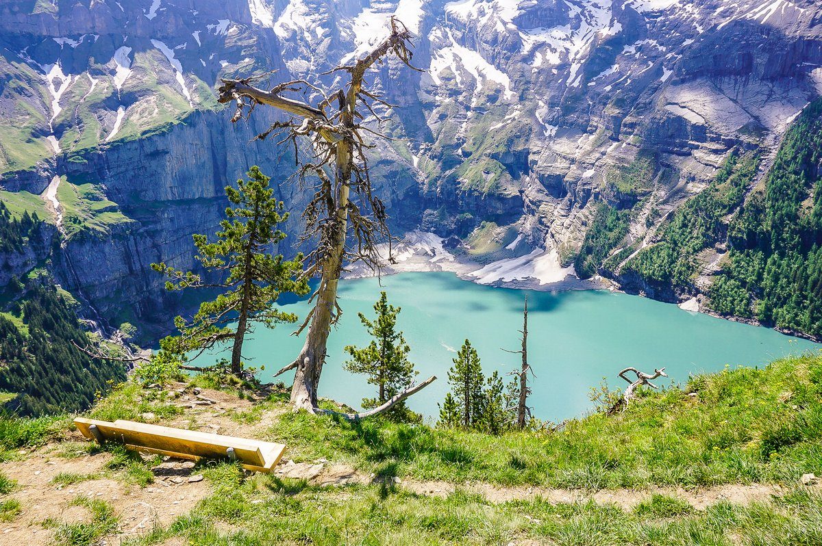
Located on the panoramic hiking trail, this vantage point provides an elevated look down at the entire lake basin.
Visit during the morning to capture the best light on water.
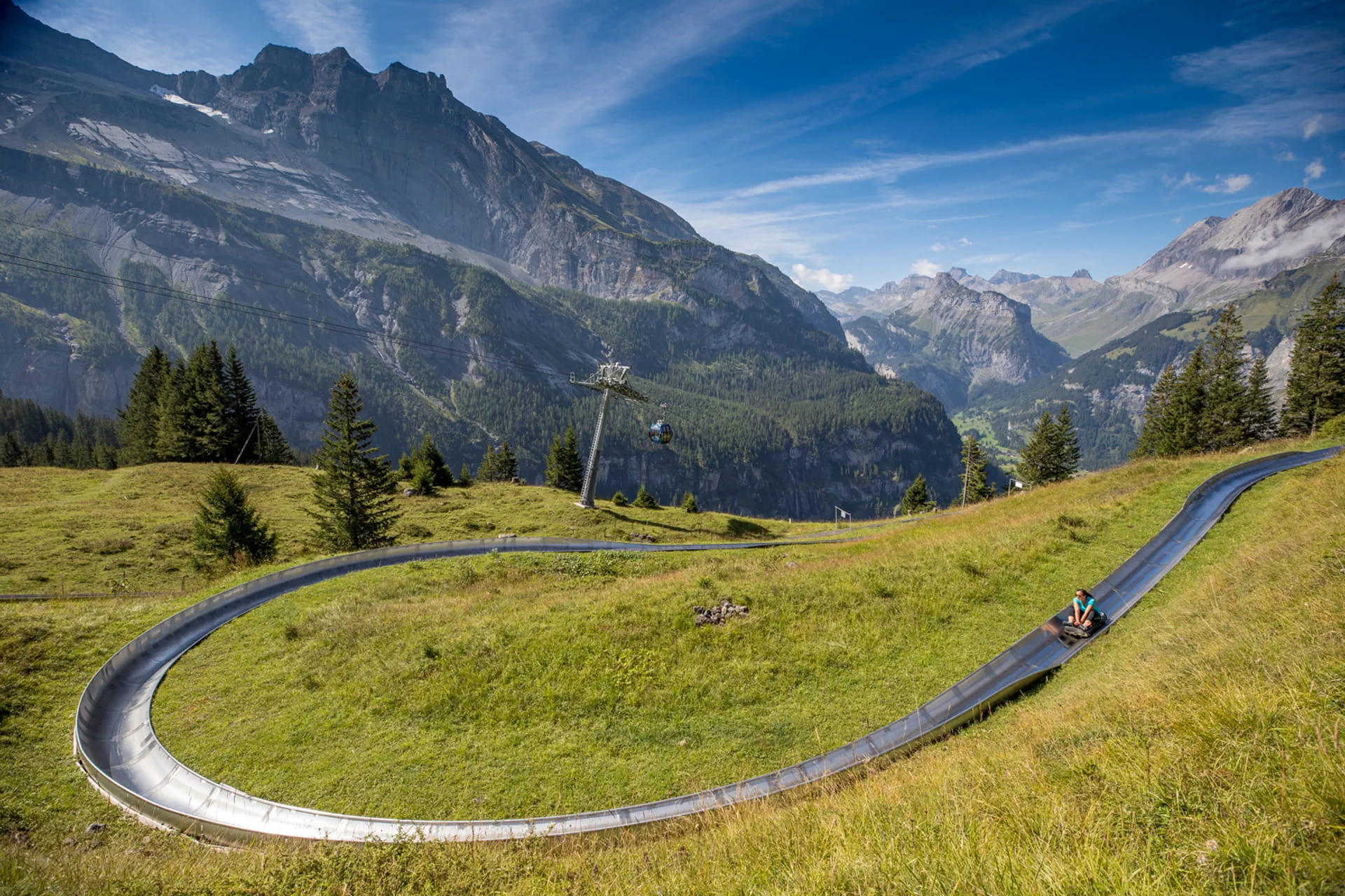
Situated near the gondola mountain station, this gravity-powered track offers a different perspective of the alpine landscape.
Check for operational status before heading to the starting gate.
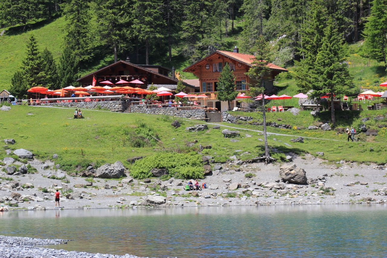
This historic mountain restaurant offers a place to rest with views of the valley and local peaks.
Sit on the outdoor terrace for a direct view of the lake.
Everything you need to know about kandersteg to lake oeschinen hike
The trail difficulty varies depending on your chosen path, but the walk from the mountain station is generally accessible for most visitors. Proper footwear is recommended for your kandersteg to lake oeschinen hike to ensure comfort on gravel sections.
Entrance to the lake area is 0 CHF as it is a public nature site. Please note that a fee applies to the Kandersteg-Oeschinensee gondola if you choose to use it to reach the upper trailheads.
To enjoy the path in peace, the best arrival window is 08:30–10:00. Arriving early helps avoid long wait times and ensures parking availability during peak season.
Hiking from Kandersteg village up to the lake typically takes between 60 to 90 minutes depending on your pace. This duration for the kandersteg to lake oeschinen hike excludes stops at viewpoints or the alpine water.
Yes, you will find mountain huts and dining options near the lake offering refreshments. These establishments provide a convenient place to rest during your kandersteg to lake oeschinen hike.
The most direct route is taking the gondola from the valley station, which significantly reduces the vertical ascent. You can then continue your alpine adventure by walking the remaining distance to the shoreline.
Many families enjoy the path, though it is important to choose the route that matches the fitness levels of your group. The primary access from the gondola station is well-marked and widely used by visitors of all ages.
Vehicle access to the lake is restricted for private cars. Visitors should park in the village and proceed on foot or use the mountain transport to access the trail network.
Lake Oeschinensee Hike Duration & Time
Read more GuideHike to Oeschinen Lake: Getting There
Read more GuideLake Oeschinensee Hike Seasonal Opening
Read more Tickets & toursLake Oeschinensee Hike from Interlaken
Read more GuideLake Oeschinensee Hike Difficulty & Length
Read more GuideLake Oeschinensee Hike Trail Map & Route
Read more