
English| EUR
Suggested for you
More currencies
Choose a language
The path out of Kandersteg gains height from the first bend, and most travellers want to know how much before they commit. This Lake Oeschinensee hike difficulty guide explains what an Oeschinensee Wanderung actually demands: gradient, surface, and the point where the gondola changes the calculation. It sits among the gentler Bernese Oberland day walks, but gentler is not the same as flat.
Quick answer
The hike from Kandersteg to Lake Oeschinen is graded moderate: about 400 metres of ascent on a wide, well-surfaced path with no exposed sections. Reasonably fit walkers of most ages manage it, and the gondola removes the climb entirely if preferred. The one caveat is season — shaded upper bends ice over from late autumn, and the higher balcony trails above the lake are markedly harder.
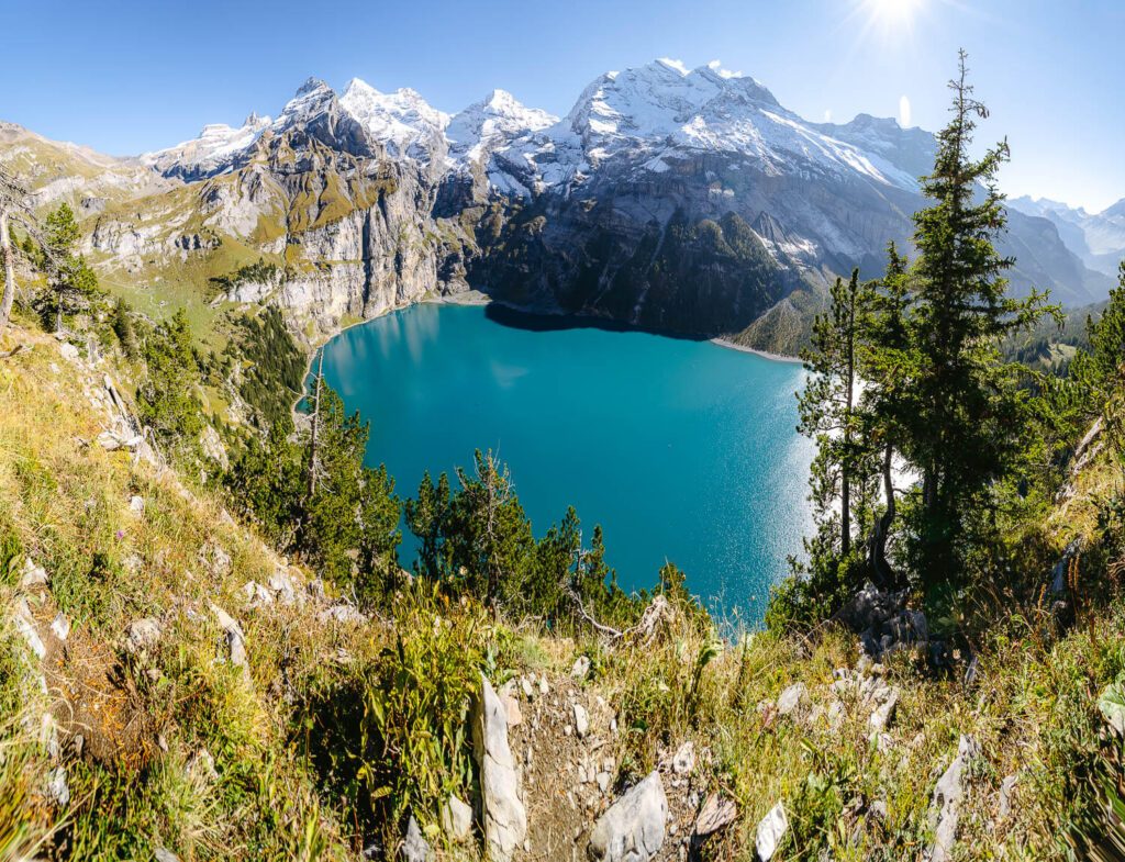
Oeschinensee has no visible outflow. Water leaves the lake underground, filtering through fissures in the limestone before resurfacing further down the Kander valley. The basin was sealed long ago by rockfall from the Doldenhorn massif, which is why its walls rise so abruptly: Blüemlisalp, Fründenhorn and Oeschinenhorn hold snow into midsummer while the shoreline below turns pasture green. That geology explains almost everything walkers feel underfoot. The question of lake oeschinensee hike difficulty is, in practice, a question about a moraine slope — the debris apron between Kandersteg village and a lake held at roughly 1,578 metres. The main route from Kandersteg follows a broad service track that gains height in long, even bends rather than steep pitches. Its surface is compacted gravel throughout, wide enough for two walkers abreast, and free of exposure, ladders or scrambling. Fitness matters more than technique here; the effort is sustained rather than sharp. Families manage it regularly, though the gradient is unkind to pushchairs and to anyone carrying a toddler. A Wanderung zum Oeschinensee taken on the narrower forest variant feels harder for the same altitude, trading gravel for roots and shade. Above the water, the picture changes again: the balcony path toward Underbärgli, Oberbärgli and the Hohtürli pass belongs to a different category of Bernese Oberland trail, with cabled sections, loose ground and real consequence. Many visitors conflate the two when they compare notes online, which is where confusion begins. Season shifts the grading more than any guidebook symbol. In August the lower slopes are dry and the lake path is busy with day walkers from across the Jungfrau-Aletsch UNESCO region; by late October the shaded upper bends hold ice, and the higher circuits close informally as snow settles on the Blüemlisalp side. Afternoon thunderstorms build fast against the headwall in high summer, which is the practical argument for starting early rather than a matter of taste. Descent deserves its own thought: knees register the loss of height on gravel more than the gain, and walking poles do more good on the way down. Sturdy shoes with grip are the minimum, and water is worth carrying even though the ascent is short by alpine standards. Read that way, the answer becomes a planning decision rather than a verdict. Walkers who train occasionally, tolerate a steady incline and choose their footwear will find the Kandersteg lake hike well within reach, while those who prefer a shorter effort can let the cable car absorb the climb and keep the walking for the shoreline circuit, which is close to level. Anyone aiming higher — toward the alpine pastures, the Heuberg viewpoint or the huts beneath Blüemlisalp — should treat that ambition as a separate outing with separate margins for weather and daylight. Judged honestly, lake oeschinensee hike difficulty is moderate and entirely manageable, provided the walk is matched to the body doing it. The dedicated sections below set out the elevation profile, the timings, the transport options and the practical figures that turn this framing into a plan.
“The question of difficulty here is really a question about a moraine slope, and moraine slopes are steady rather than steep.”
This procedure walks you through choosing between the two main walking routes to Lake Oeschinensee and reading the gradient before you commit to it. Working through the steps takes a few minutes of planning and shapes the physical effort of the whole day.
Decide whether you want a sustained uphill effort or a mostly level walk, since the two routes differ by roughly 400 metres of ascent. Most people underestimate the climb because the distance from Kandersteg to the lake is short — it is the gradient, not the kilometres, that decides difficulty.
The direct path from the cable car top station drops about 200 metres to the shoreline on a wide, graded gravel track rated easy (T1). The error here is forgetting that the descent must be reversed on the way back, which turns an easy walk into a moderate uphill return.
The panorama variant contours the hillside above the valley on a narrower mountain path with several exposed sections and short rocky steps, rated moderate (T2). Walkers with a fear of heights or unsteady ankles often start it without realising there is no easy turnaround point midway.
Climbing on foot from Kandersteg village to the lake gains roughly 500 metres over a forested service road with a steady 10 to 12 percent gradient. People commonly attempt this in midday heat without shade planning, which is where the route bites hardest.
Both routes carry loose gravel, and the panorama path holds wet patches and old snow into early summer. Trainers with worn soles are the single most common cause of slips on the descent.
Choose a landmark on the trail where you will turn back if the gradient feels harder than expected, rather than pushing to the lake and struggling to return. Judging this at the start, when legs are fresh, prevents the classic mistake of overcommitting.
Verify current trail status for the season with the operator on +41 33 675 11 18 or at https://www.oeschinensee.ch before you travel to Oeschistrasse 50, 3718 Kandersteg. Signage on the mountain can lag behind closures after storms or rockfall.
This plan suits walkers of average fitness who want the full lake circuit plus viewpoint stops without rushing, and runs about six hours from arrival at Oeschistrasse 50 to the return descent. Faster hikers can compress it to roughly four hours; families with young children should budget closer to seven.
Reach the valley station on Oeschistrasse and allow 20-30 minutes for the cable car queue and boarding before the trail time starts.
Walk the gravel service road down to the lakeshore, roughly 20 minutes at a steady pace or 35 minutes with photo stops.
Follow the flat northern shore past the rowboat jetty and restaurant terraces, about 25 minutes of easy walking on level ground.
Continue on the lake circuit path toward the Unterbargli side; allow 1 hour 15 minutes at a moderate pace, longer if the scree section is wet.
Stop above the water for the Blüemlisalp and Fründenhorn panorama, budgeting 20-30 minutes to sit, eat and rest before turning back.
Retrace or complete the loop back to the lakeshore in around 1 hour 10 minutes; poles help on the descending sections.
Eat at one of the lakeside restaurants, allowing 45-60 minutes since kitchens fill quickly between 12:30 and 14:00.
Walk 30 minutes uphill to the upper station, or take the marked valley path down to Kandersteg in roughly 1 hour 15 minutes.
The period from late June to September provides the most reliable trail conditions for hiking, as snow melt typically clears the higher paths. To minimize congestion and temperature exposure, maintain the best arrival window: 08:30–10:00.
Warm, 15°C to 22°C. Paths are fully accessible and snow-free.
Cooler, 8°C to 16°C. Stable weather with clear visibility.
—. Optimal time to navigate technical sections before midday heat or cable car peak traffic.
Verdict: For the most manageable hike conditions, target weekday mornings between late June and early September.
Lake Oeschinensee is located above the village of Kandersteg in the Bernese Oberland. The most efficient way to reach the starting point for hiking trails is to travel to Kandersteg and use the local cable car.
BLS line to Kandersteg station
Local bus to Kandersteg, Cable Car station
Oeschistrasse 50, 3718 Kandersteg
Kandersteg cable car valley station to mountain station
For the best experience, plan your arrival between 08:30–10:00. This window helps you avoid peak crowds and ensures you secure available cable car time slots.
The cable car to Lake Oeschinensee operates daily to provide access to the hiking trails near Kandersteg.
Access to Lake Oeschinensee itself is free of charge. Visitors requiring assistance to reach the trailheads may utilize the Kandersteg-Oeschinensee cable car, for which official fees apply.
Verdict: A typical adult pays 30.00 CHF for a return cable car ticket, with costs varying based on whether a one-way or round-trip option is selected.
Everything you need to know about lake oeschinensee hike difficulty
The lake oeschinensee hike difficulty is generally considered moderate, primarily due to the steady incline from the mountain station. Hikers should be prepared for gravel paths and occasional steep segments that require sturdy footwear.
Many visitors find the path from the Kandersteg cable car station manageable, though it still presents a physical challenge. The Oeschinen Lake trek is well-marked, but the elevation gain remains a significant factor for those unaccustomed to mountain walking.
Most hikers spend between 30 and 45 minutes walking from the top cable car station to the water. Those choosing to hike from Kandersteg village should account for a much longer, strenuous climb of approximately 90 minutes or more.
While the route is popular, the lake oeschinensee hike difficulty may be strenuous for young children or those without proper mountain gear. Parents are advised to stick to the main designated paths and monitor energy levels closely during the ascent.
Yes, the trail complexity varies significantly; the panorama trail is more demanding than the direct route to the shore. Understanding the varying topography is key to accurately assessing the lake oeschinensee hike difficulty for your fitness level.
We recommend arriving between 08:30 and 10:00 to avoid crowds and ensure you have ample daylight for your trek. Checking weather conditions and ensuring you have sufficient water and stable shoes will help you navigate the terrain safely.
Kandersteg to Lake Oeschinensee Hike Guide
Read more GuideLake Oeschinensee Hike Duration & Time
Read more GuideHike to Oeschinen Lake: Getting There
Read more GuideLake Oeschinensee Hike Seasonal Opening
Read more Tickets & toursLake Oeschinensee Hike from Interlaken
Read more GuideLake Oeschinensee Hike Trail Map & Route
Read more